 Listen to this article
•
15:34 min
Listen to this article
•
15:34 min
Winter mornings in Pachmarhi can be cold. Perched on the plateau on a cold December morning, I was looking forward to my day in the Satpura Tiger Reserve in central Madhya Pradesh. I was with a team from Wildlife Conservation Trust (WCT) studying Eurasian otters (Lutra lutra). Eurasian otters are an enigmatic species that disappeared from our consciousness for several decades, only to reappear in the unlikeliest of places. The Satpuras now seemed like the centre of their distribution range. I was tagging along with a team led by the ever-cheerful and soft-spoken Prasad.
Echoes of Sandstone and Basalt
Pachmarhi is a quaint hill station perched on the Satpura mountain range, a chain running from Chhattisgarh to Gujarat. The Satpuras demarcate the Indo-Gangetic plains from the Deccan Plateau. The town, surrounded by forests, was initially developed as a sanatorium and then a cantonment during the British Raj. To set the context for this vast and ancient landscape, the Satpura region is far older than the relatively recent Himalayas. This region was profoundly shaped by extensive volcanic activity during the Late Cretaceous period (100.5–66 million years ago), as evidenced by the abundance of basalt (an igneous rock formed by volcanic activity). Within this geological region, the Pachmarhi plateau rising from the surrounding landscape, is largely characterised by multiple layers of sandstone (a sedimentary rock), and is dissected by deep river valleys with cold, clear water that cuts through the sandstone. Nature’s work, and it hasn’t stopped for millennia. The Denwa River and its tributaries have drained this ancient land, home not just to incredible biodiversity but also to prehistoric hunter-gatherer civilisations, who left behind some of the oldest cave paintings and rock art in the Indian subcontinent.
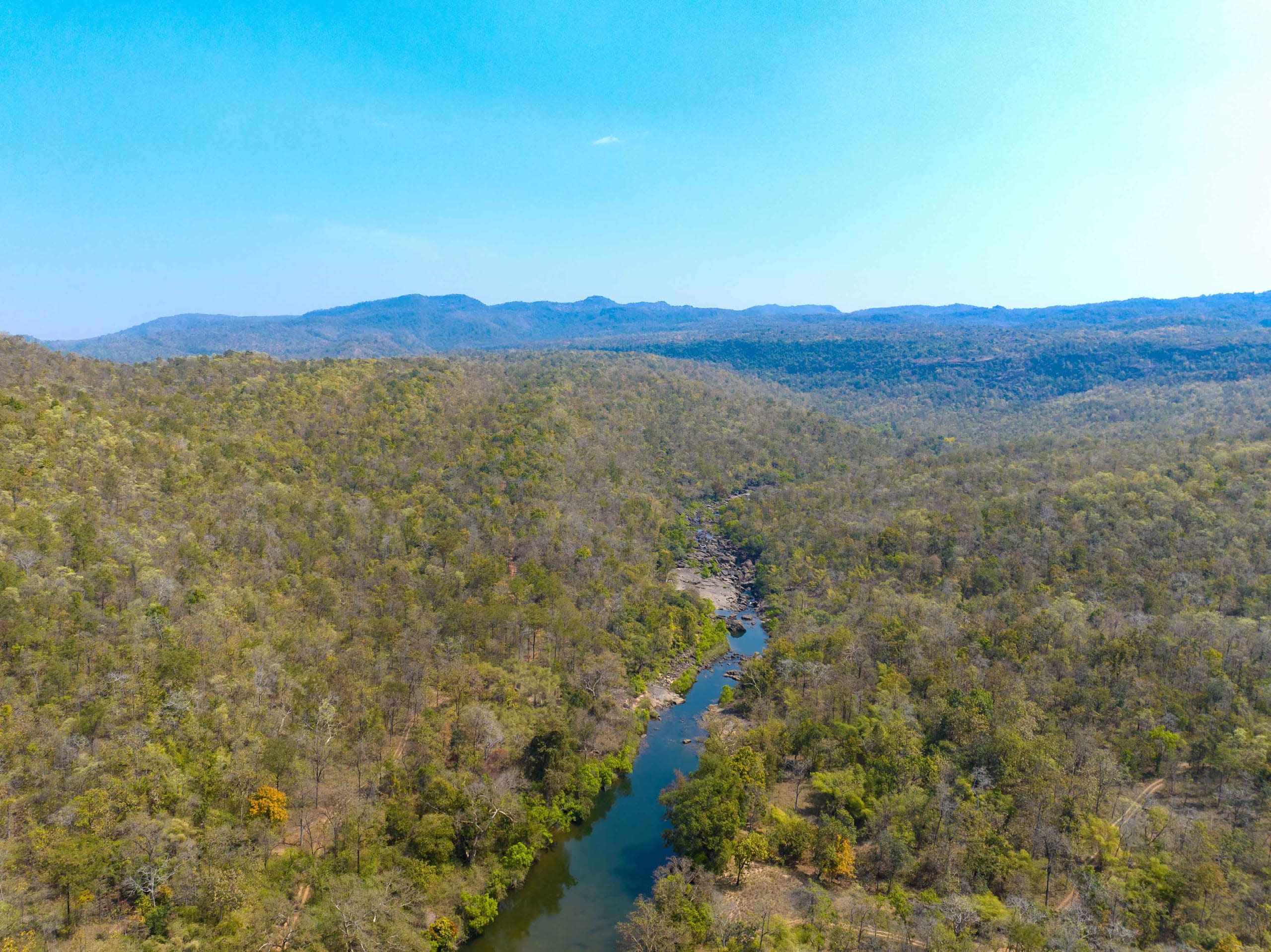
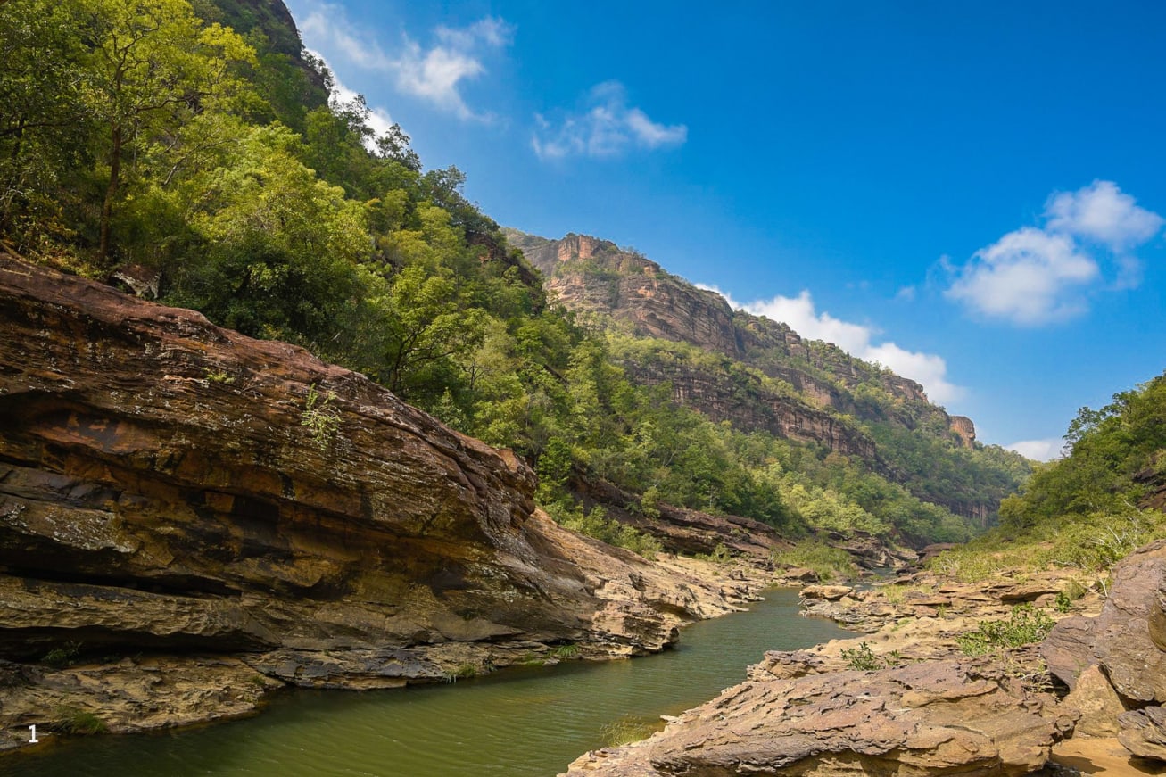
Cover Photo: Satpura Tiger Reserve has a diversity of forest types — moist deciduous, dry deciduous, riparian and even evergreen in some patches. Teak is found in the lower elevations and plains, and sal in the more moist, higher elevations. Perennial streams and rivers form a dendritic network among these rugged hills and gorges. Photo: Aditya Joshi
Down to the Nagdwari
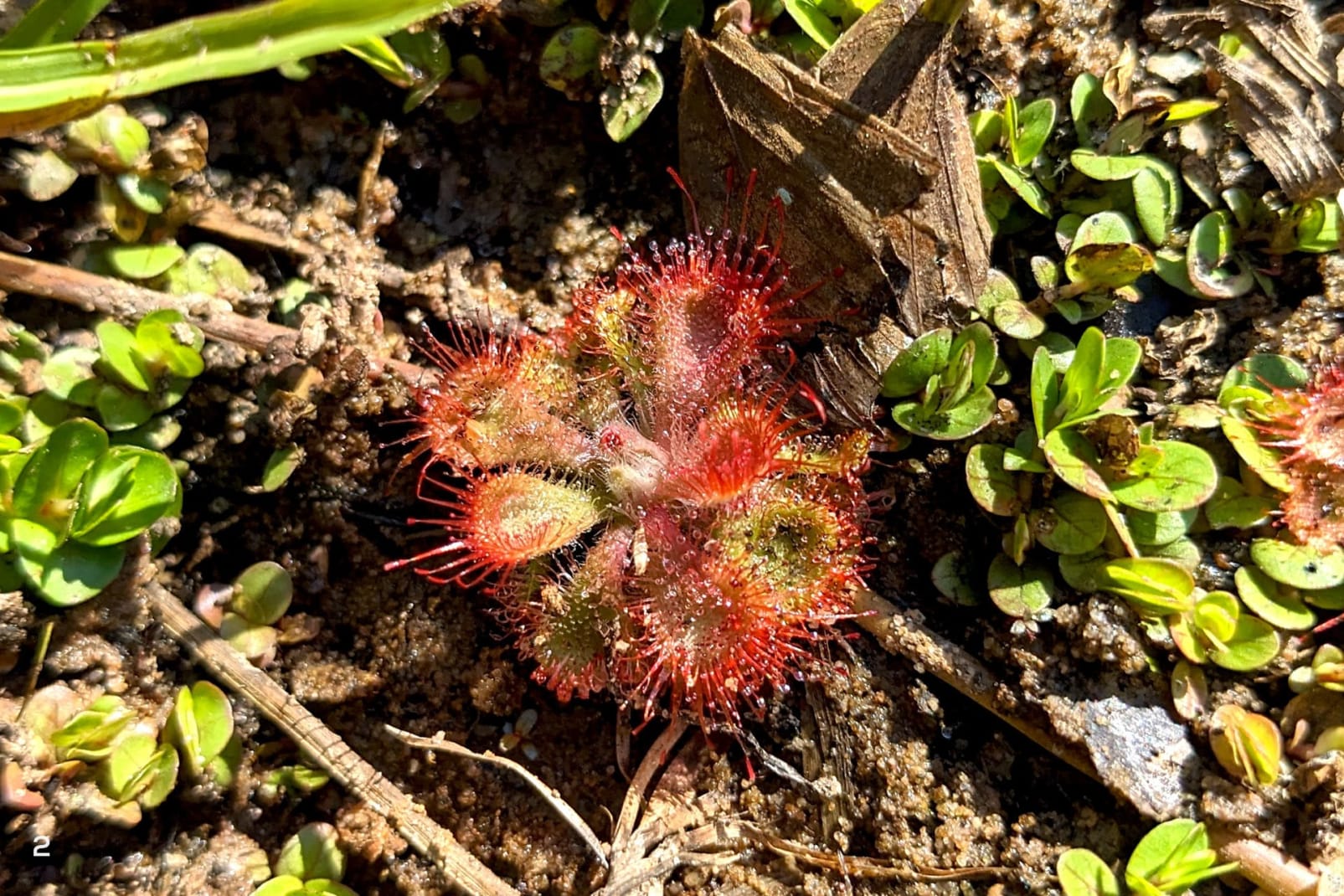
For us, a landscape of gorges and valleys often meant that a road would end and a trail begin. Steep descents awaited us each day. The first day alone was enough to set my knees shivering from the gradient. I slipped and slid my way down the gorge, but once there, I was struck by the colour of the Nagdwari River. A deep blue-green and spookily clear as glass, the riverbed was visible, 5 m deep (or more) in places. High rock walls rising on both sides blocked sunlight, and an eerie silence kept the clear water company. This is a landscape of sandstone and bedrock, with water cutting through and carving deep river valleys. The steep slopes have a thin layer of soil sprinkled over them, to which trees and tree-like lianas cling like giant serpents snaking their way through the canopy. Tree ferns and carnivorous sundew are part of this ancient landscape. Being there is like going down a geological time line, layer by layer, with water at its heart.
Shadowing the river hunter
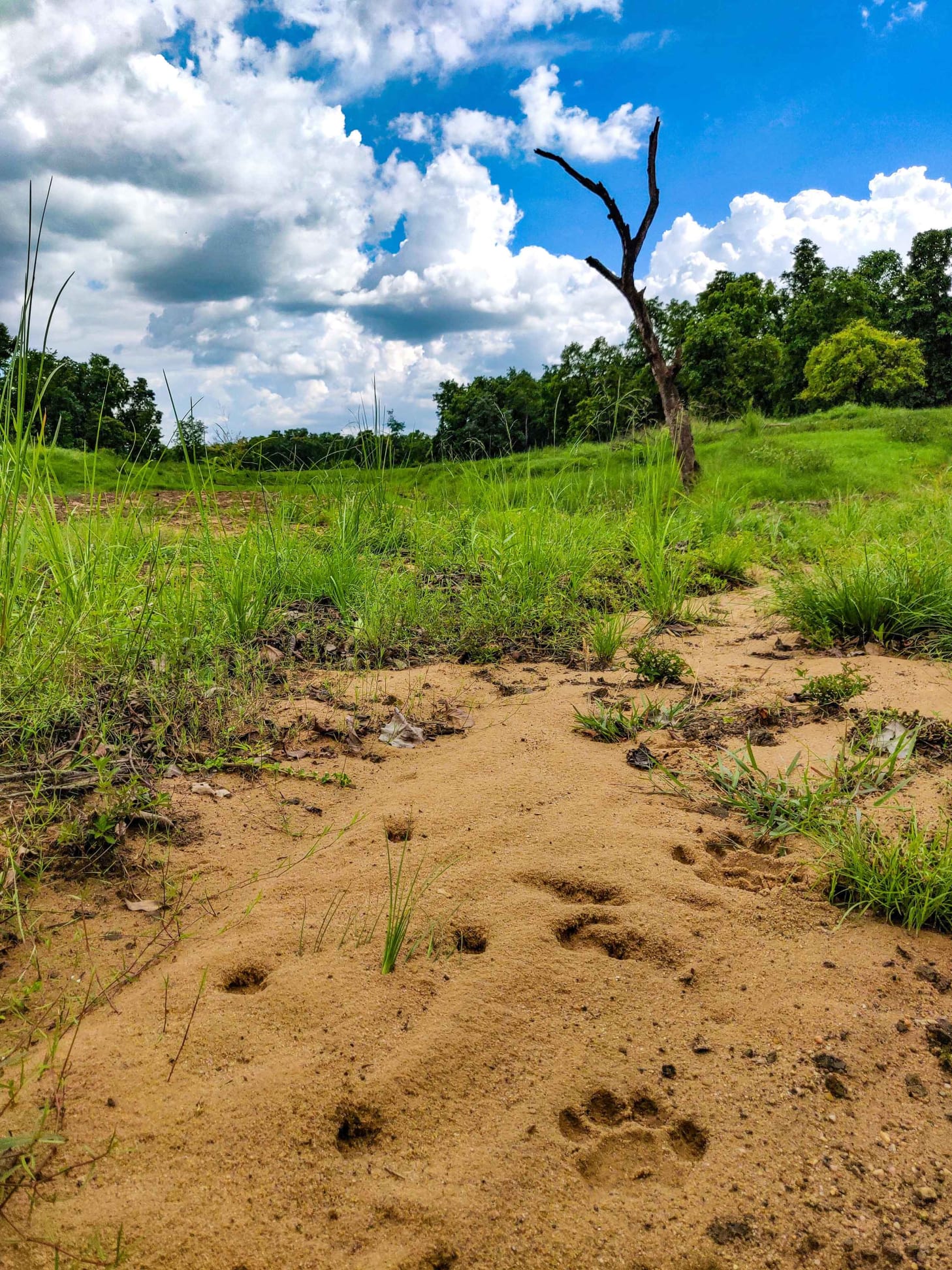
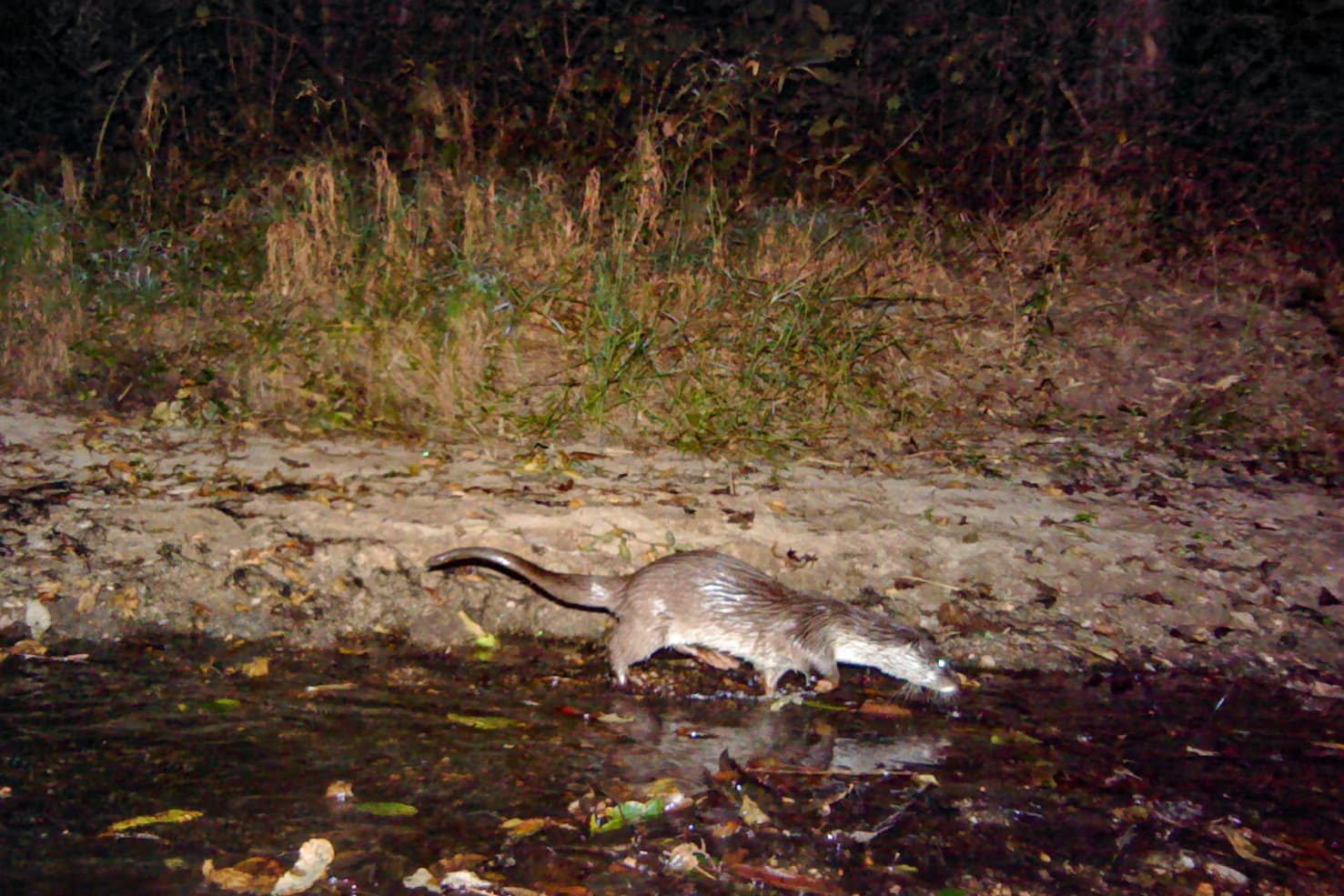
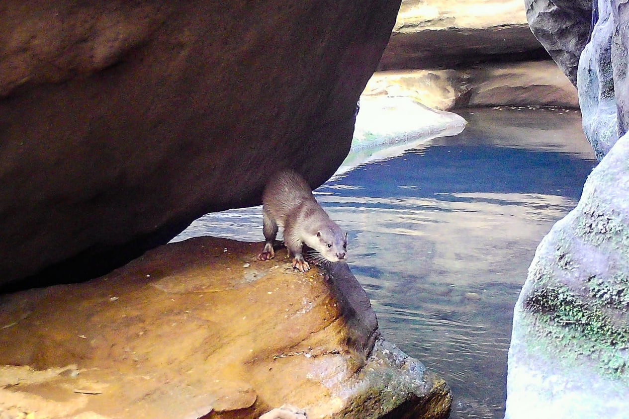
Walking through these gorges and valleys was easier said than done. What looked like camera-trap locations on a map involved leaping from rock to rock, some acrobatics, and creeping along narrow ledges. Where sunlight managed to peer in, there were short grassy banks. The Eurasian otters that drew us to these valleys and gorges are notoriously hard to spot, but often leave traces behind. Paw prints in sand, scat (spraint) on rocks, but little else. Elusive animals are best captured on camera traps — remote cameras that snap a photo when they detect heat or motion in their field of view. Eurasian otters have been photographed numerous times with such cameras, revealing, over time, hidden aspects of their behaviour, activity patterns, and evidence of breeding.
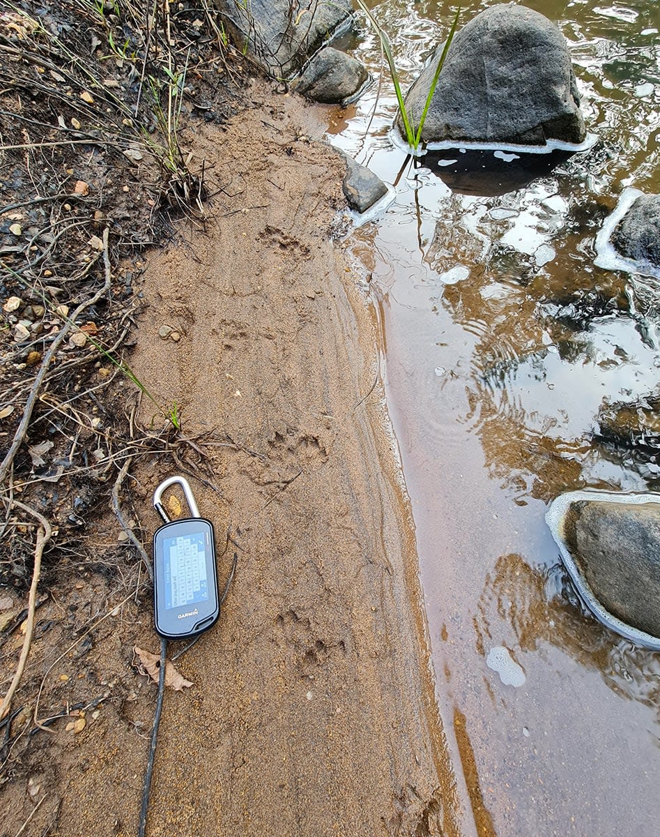
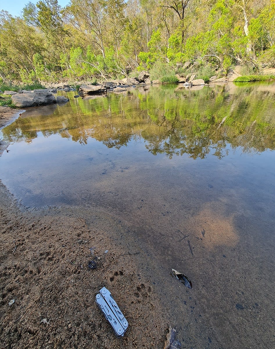
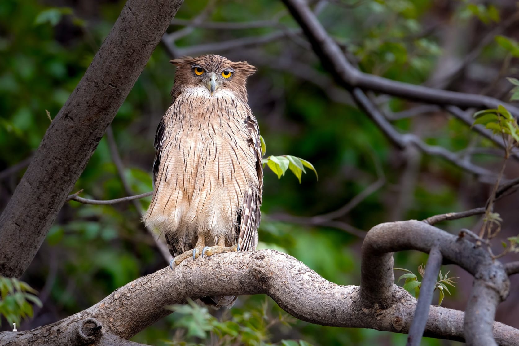
In the Satpuras, flowing water keeps the bedrock company even through the driest summer. Bedrock is the hard, solid rock beneath the weathered surface — while bedrock might seem hard and impenetrable, it is not unbreakable. As time flows, water may carve its way through this seemingly impervious substrate. Field work is only possible during the dry season. My first day with the field team started on the plateau in the deciduous forests at Teenkoda Camp. After descending the steep slope, we reached the Nagdwari River. Data sheets were readied, equipment checked, and we started trudging downstream, hugging the river closely. The team recorded large pools and measured depth and other key parameters (water flow, fish presence, water quality, sandbanks). We were constantly on the lookout for signs of otters. Eurasian otters are largely active during dusk and after dark, so we weren’t expecting to see any animals during the day. We scanned the sandy and clayey banks for paw prints. Checking previously installed camera traps for photos revealed numerous secrets — photos of otters balancing on rocks, a brown fish owl trying to steal an otter’s catch, otters with pups, and tigers.
The Riparian Soul
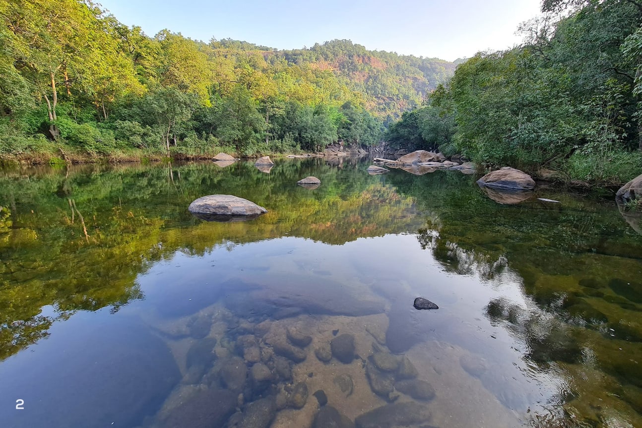
A crested serpent eagle kept us company. On numerous occasions, we came across large tiger pugmarks, all less than a day old. The tiger(s) seemed to be following the same route downstream as us. To be walking in the footsteps of a large predator in a remote valley was enthralling to say the least. Towering rocks, cool air, clear water, signs of tigers and otters — these kept my mind clear and hooked to the present. After what seemed like many hours of slow progress, we reached Gondia Camp. Our river transect (fixed distance traversed over a period of time) for the day ended here, and after a late lunch, we headed to the Singpura Camp located further downstream in a broad valley. Warm evening light bounced off the glassy calm Nagdwari, the riparian forest throwing a mirror image in the water. A troop of langurs settled down for the night on a large riverside tree. With the sun setting behind the hills, a chill settled like a fog.
Telemetry: Mapping the Future of Otter Conservation
As we sipped hot tea, I learnt that Singpura is one of the main sites for the Eurasian otter telemetry project (a joint project of the MP Forest Department and WCT). Otters are going to be temporarily captured, a transmitter attached (by a trained wildlife vet), and then released back to the same place — an exercise that needs months of planning. The transmitter pings back the location of the animal every few minutes/hours, enabling the research team to understand movement, home range of the otter, places it spends more time (such as denning sites), activity times, and the areas it prefers, thereby throwing more light on the ecology of this elusive species. The findings from this study would help us understand how otters survive outside protected areas, the habitats they prefer, and the conservation measures needed to ensure their continued survival.
Calming waters
Our river transect the next day was along the Mithijhiri, more a placid stream than river — a series of pools connected by runs and riffles. As I sat beside the river, my thoughts drifted to my dog, Noah, back in Bangalore, and how he kept me tethered in an uncertain world. Similarly, there’s a sense of kinship with rivers and streams. Water keeps me tethered; it haunts me and brings me calm at the same time. Back along the Mithijhiri, our river transect wound its way downstream along a rocky river that did not match the grandeur of the sandstone-carving Nagdwari. I had felt insignificant along the Nagdwari, equal parts fear and fascination, but the Mithijhiri was a gentler being. After the initial descent to the river, we did not have a difficult time completing the day’s work. We found otter signs here as well, filled our datasheets, and diligently recorded the various parameters. One striking observation was that these free-flowing rivers had very low TDS (total dissolved solids), indicating undammed, unpolluted water. Our day ended at a grove of citrus trees heavy with bright orange fruits.
There was a tiger active along this valley, too. Did they prefer moving along river valleys to traversing steep slopes? Were they haunted by waters as well?
Undammed and unpolluted
The next day, we went back to another river valley. The Bainganga is unlike both the Nagdwari and Mithijhiri. After 1.5 hours of descent, we reached the river. Rocky and forested in places and open with tall grass and marsh in others, the Bainganga was forever changing, much like its landscape. It seemed like the Eurasian otters used the entire network of rivers and streams draining the Satpura Tiger Reserve. This was confirmed by Prasad and his team and WCT’s camera-trap results. We repeated the data-collection drill along the Bainganga, flushed a large owl along the river, saw an Indian giant squirrel in the riparian forest, stumbled upon more tiger pugmarks, and broke for lunch at the confluence of the Bainganga and Barana, another forested, clear-water river. It was late in the day by the time we finished our river transect. A 5-km walk through the forest awaited us, and a final crossing of the large, sandy Denwa to reach our pickup point on a motorable road.
Fading evening light found us on the forest road leading to the Denwa, and we discovered that we were not alone. Dispersed as we were, fresh tiger pugmarks accompanied us all along. We could only wonder if the tiger was just a little distance ahead by the bend in the road. The pugmarks led us to the camp by the Denwa, but our tiger had melted into the forest and gathering darkness.
The Mithijhiri flows into the Nagdwari, and both Nagdwari and Bainganga flow down to meet the Denwa. We had begun our meanderings up on the plateau, walking from river to river, to finally arrive at the Denwa — the lifeblood of this thriving, ancient landscape. The otter and tiger were a constant presence all along, and finally, wading across the Denwa at the end of the day, I couldn’t help wondering if we were but a ripple in still water.
About the Authors


Aditya Joshi
is a wildlife biologist who focusses on large carnivores, wildlife corridors, forest hydrology, pangolin conservation, and wildlife detection K9 units.