 Listen to this article
•
15:34 min
Listen to this article
•
15:34 min
I was five when my parents moved to Kaziranga in Assam. It was mid-June 2014, and the annual flooding of the park was at its peak. While the park was inundated, most animals had to temporarily head south beyond the national highway to access the Karbi hills. Signs saying “Animal Corridor, Drive Slow” could be seen where animals crossed the highway (NH37) and wild animals waited along the highway to find safe passage through. I remember the intensity of the rain and the darkness that surrounded our car as we passed through the animal corridor. We saw elephants hurriedly crossing the road in front of our car. A herd of deer hid behind the bush beside NH37, waiting to cross. NH37 is the lifeline of Northeast India, strategically critical for trade, transport, and access.
Ten years later, things have changed as much as I have. I have grown significantly in height, and so have the trees I saw as newborn shoots. My eyesight has worsened post-pandemic, and so has the highway traffic. My residence has changed, as have the banks of the Brahmaputra. NH37 has now become NH715.
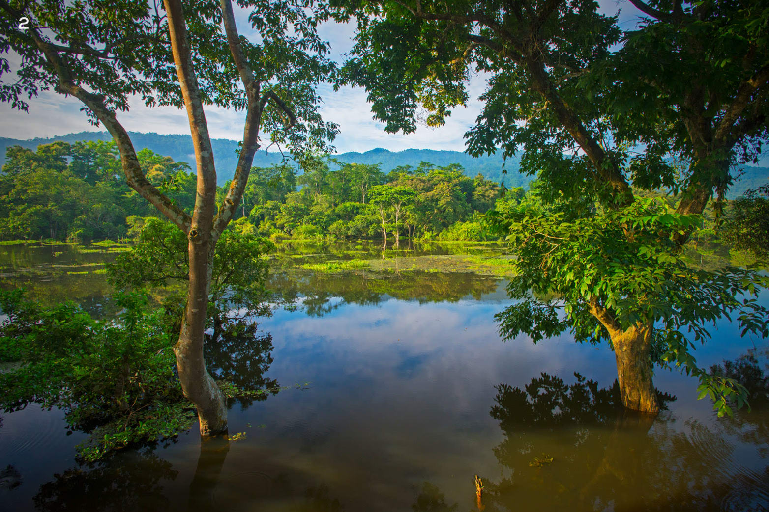
Kaziranga National Park lies in the floodplains of the Brahmaputra and floods every year. While this is a natural process that energises the ecosystem, 2024 saw an unforeseen and unexpected rise in water levels. The flood came in quickly and receded as fast. Usually, the monsoon flooding takes three or four days to reach its peak. However, in 2024, the water took just two nights to fill the plains. The park’s animals naturally started to cross NH715 to get to the Karbi Anglong highlands, while some sought refuge in the high grounds the forest department had constructed. I imagine wild animals must have seamlessly moved between the existing national park and the Karbi hills for hundreds of years without the highway creating a barrier. It was during World War II that long-term tarring of this road began. The road brought new development prospects, opening this land and its bountiful resources to exploration and exploitation.
Both animals and humans were affected. Villages in the forest fringes flooded overnight, making it hard for people to move to the highlands or the roads. The people of this region have seen decades of floods. Experience, readiness, and skill have always been their asset. While some villages are in non-flooding areas, others have learned to face this scenario of flooded houses, fields, and croplands. They know the benefits of living in a floodplain, as did the generations before them.


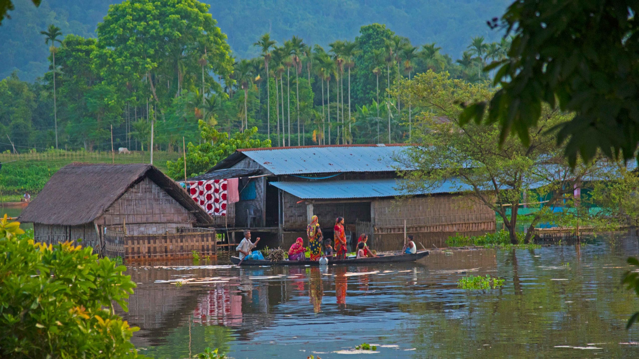
Floods are the lifeline on which a whole ecosystem of animals and people rely. (1) With the gush of water, fish pour in, creating an opportunity for the locals. (2) With the turbulent rise of water, the rural settlements at the park’s fringes start to submerge. Once the floods recede, the local people will rebuild these huts made of readily available materials like bamboo, straw, and mud. Photos: Nalin Pandey (1), Dhritiman Mukherjee (2)
Cover photo: When the Brahmaputra floods near Kaziranga, it becomes a swollen superhighway along which villagers use boats to transport people, animals, food, first-aid, etc. Photo: Dhritiman Mukherjee
The River Brahmaputra is the lifeline of Assam both for economic activity and the ecological diversity it hosts. The flooded Brahmaputra brings silt to the villages, a vital component of soil fertility and rejuvenation. Villagers rear cattle, goats, buffalo, pigs, and chickens. Once their crops are harvested, they leave these animals in the fields to eat the stubble, while their droppings replenish nutrients to the soil — ready organic matter which farmers elsewhere in India may have to buy. Silt and manure are the reasons for the health of the soil in these parts. Thanks to this cycle and the floods, I get to enjoy and cherish pesticide-free Joha rice and delicious bhul (gourd).
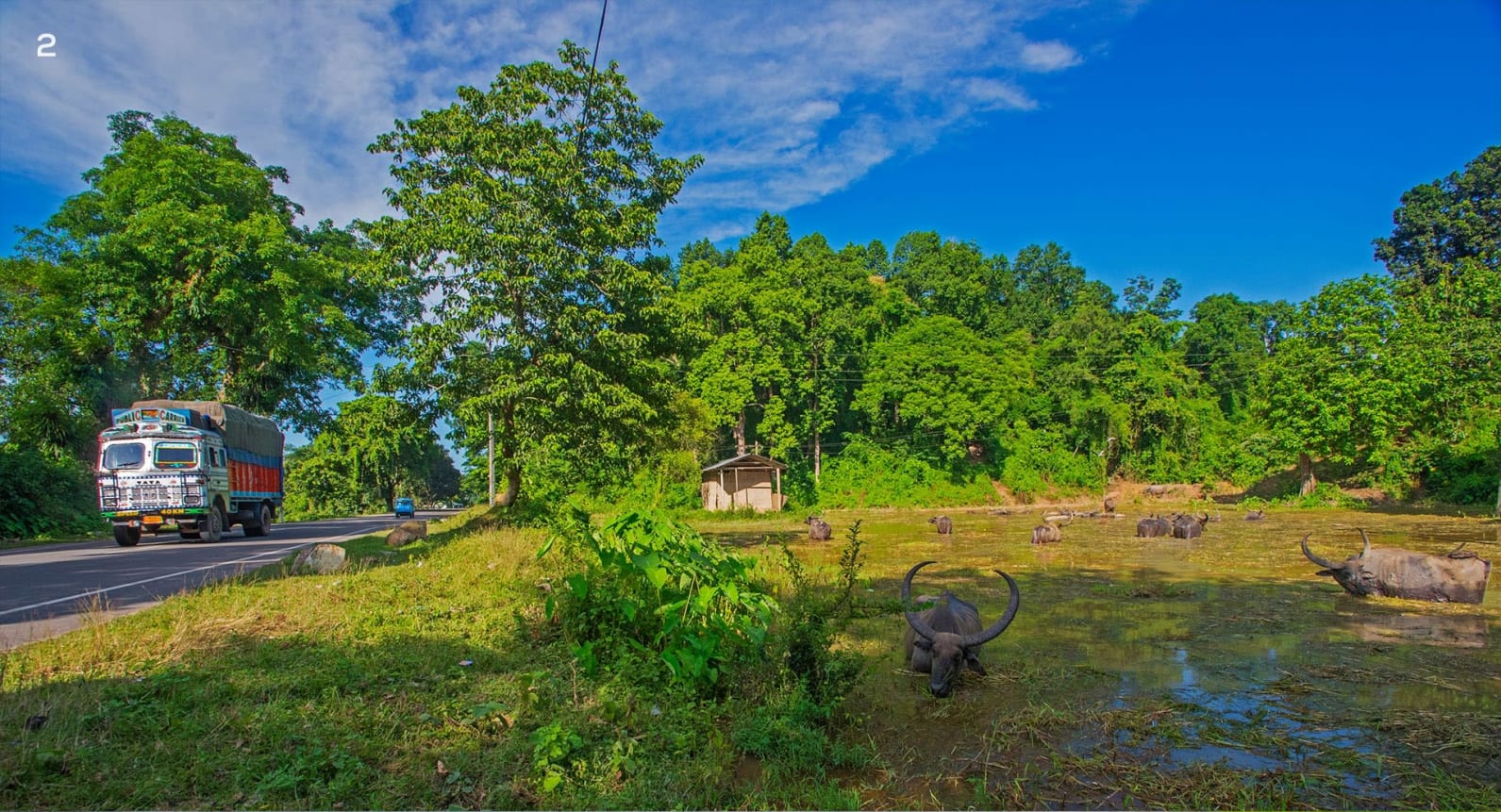
Across the forests and villages of Kaziranga is a matrix of waterbodies. These waterbodies are the baseline for the whole ecosystem and for the success of agriculture in the countryside. Some waterbodies are rain-fed, others replenished by streams from the hills, but most are the gift of the annual flooding. Like Sohola Beel near Kathpora village, several wetlands dot the grasslands of Kaziranga. Healthy waterbodies like these have a good population of reptiles, fish, and insects and support the food chain. Big mammals such as elephants (Elephas maximus), one-horned rhinos (Rhinoceros unicornis), and wild buffalo (Bubalus arni) like to wallow in these pools to cool off in the summer. However, since the 1990s, there has been a steady decline in the depth and volume of these waterbodies, with some wetlands disappearing altogether.
Before settlements arose, these animals roamed freely between the Brahmaputra River and the Karbi hills without any worry. First, we built a road. Then, the road became a highway. New settlements (legal and illegal) sprang up. We established schools, shops, restaurants, dhabas, hospitals, government offices, new businesses and even police stations. All these institutions came with fences. This significantly reduced the open spaces wild animals could use to head to the Karbi Hills, especially during flooding. We now have left what are called corridors. We further encroach these corridors, making the escape routes for wild animals extremely difficult and almost impenetrable. What was once a single landmass from the hills to the river has now been partitioned by a road. So, aren’t we the ones who gave birth to the problem? Didn’t we come in their way?

As the flood waters start to seep in, the forest department and other associations collaborate to help reduce human-animal interactions and loss of life. Animals try to move towards the hills to prevent drowning. To reach the hills, they must cross the road between the forest and the hills; they may even cross villages. Every year, several preventive measures ensure the safety of animals and the people they might hurt in their stress or rush to reach higher ground. As all the forest guards come out of the forest, boats are used as floating camps to keep vigil and secure the forest. Speed stops are established to slow down passing vehicles on the road. Pre- and post-monsoon, animals tend to cross the highway at specific points. These points are heavily protected, and vehicles drive through them slowly. However, during the flood season, the whole road is a corridor for animals to cross, and they will use the spot most accessible to them. This requires increased security and extra vigilance.
Another measure during the peak flooding was restricting heavy vehicles like trucks from using the road, diverting them to another route. At night, this road’s primary traffic comprises buses, trucks, and petrol tankers. Keeping them away from the road reduced traffic several fold. The forest department also arranged for cars to move in groups. They created car-stopping posts where long queues of cars were gathered and led (and followed) in a motorcade by forest department vehicles, ensuring vehicles moved through the road briefly and didn’t halt or affect animals. The department made its best effort, and volunteers contributed significantly.
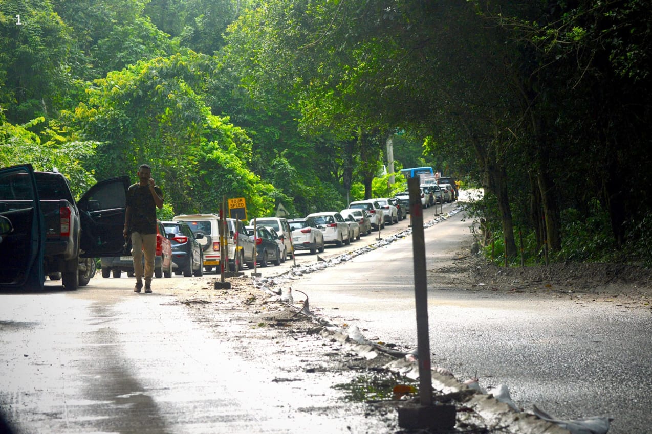
In every good venture, things may go wrong. Recently, a tiger was spotted near the road (3 July 2024), and the queues of cars had to be stopped. While this prevented any harm to the tiger, the vehicles blocked other animal paths, causing them stress. I noticed a stranded rhino on my right peeping through a window of leaves for over an hour. Fortunately, no mishap occurred. Another issue was the road construction on the Haldibari Corridor, connecting the park to the Karbi Hills. Here, a single lane had been completed, but the other side had not, causing a level difference of about ten inches in the road. If an animal had charged a car, the driver wouldn’t have been able to do anything to swerve or move away, and that could have caused significant loss.
In the ten years I have lived in Kaziranga, I have learned not just my ABCs but also about the dreams, needs, ambitions, and woes of the local people. At first, I thought the flooding of Kaziranga was destructive and needed to be stopped. But I have come to understand from the local people that floods are necessary, and one learns to live with them. Kaziranga is not Mumbai or Odisha, where floods are destructive. Here, the flood is a part of the ecosystem and livelihoods.

As I continue to live in Kaziranga, I cherish the privilege of knowing its people, their culture and challenges, and the pride they take in conservation. I have visited hundreds of households and met innumerable local folks inhabiting fringe villages. Some have lost their livestock to tigers or crops to elephants, some have lost family members, and others have survived being lifted by a tiger. Not once have I witnessed regret in the hopeful eyes of the people of this beautiful land.
Floods represent the power of nature, a miraculous occurrence. During the seasonal floods, Kaziranga’s forests, villages, and surroundings are swallowed into one big stretch of water. Just as much as Kaziranga is about animals, it is also about the people around it — the people who have shaped the boundaries of the forest and the forest that has shaped people’s livelihood. There is a strong symbiotic relationship between humans and nature that has endured the test of time and will continue to do so for centuries.
As I get closer to finishing my high school studies and gear up for further studies in an urban centre, my heart is filled with gratitude and love for all the creatures of this sacred forest, and the annual flooding that has taught me the most.
About the Authors